 4 days of non-stop racing means a race course of around 200 miles. There will be a mix of
race disciplines
combined together to make for an amazing journey through remote wilderness.
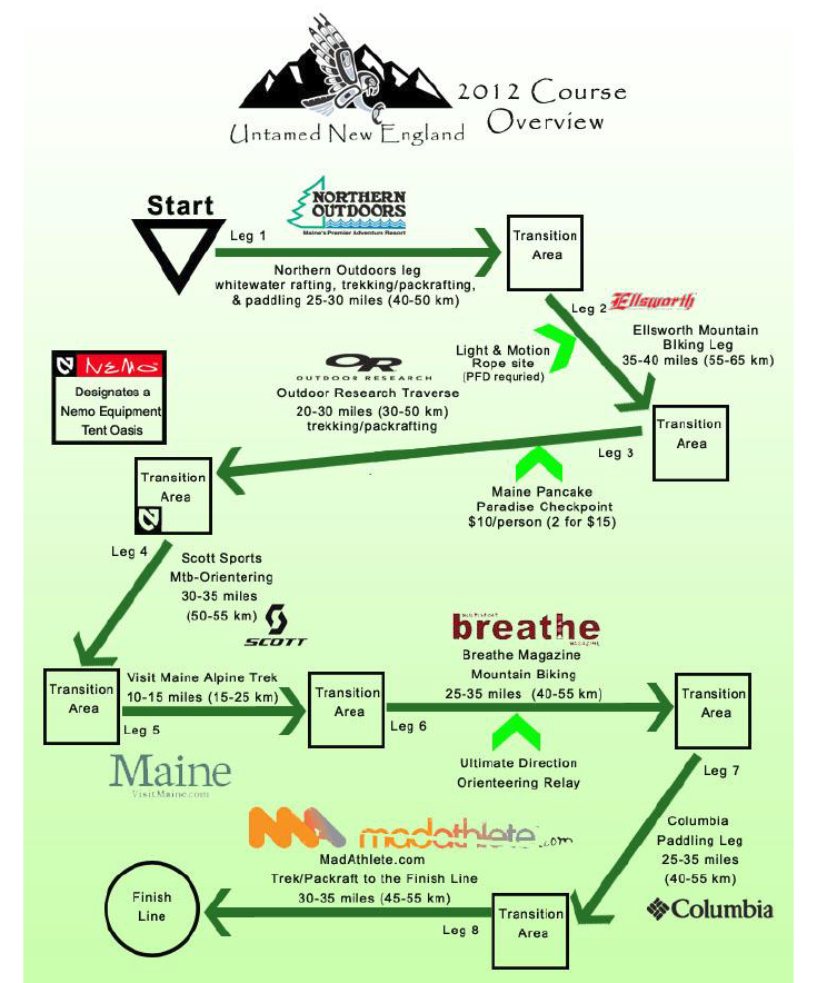
The exact race course remains a secret until the night before the race. About a week before the race, a rough course overview is distributed to
teams that shows the order of disciplines, approximate distances, and transition area logistics. This makes packing and planning
significantly easier for teams. Racers only learn the location of the race Checkpoints and map details the night before the race
start (Tues June 17th for the 2014 race). That night, as part of the fun, we usually have a
review of the race course for teams to appreciate what they've
gotten themselves into (here's the
2012 course flyover we showed to race teams just before the race)!
Before the racing starts, teams check gear bins with race staff that the organization stages at designated "transition areas"
around the race course. There may be roughly 6 such transition areas in a race, meaning teams can resupply or change equipment out a
number of times through the full race course. Teams race from one Checkpoint to the next,
finding their own route using just the race provided maps and their compasses (GPS devices are not permitted). There is a lot
of strategy involved as there are often many ways to progress from one race Checkpoint to another.
Here are some resources to help you understand what you're getting into with the Untamed New England Expedition Race -- remember,
you may not be ready for us, but we're ready for you!
- 2012 Course Overview (distributed the week before the 2012 race)
- 2012 Course Flyover Video (shown the first time the night before the 2012 race)
- 2012 Race Booklet (distributed the night before the race during the mandatory team meeting)
There's a lot more on our race HQ blog about specifics of sections of the race course
and how all these moving parts work . . . but the only way to really "get it" though, is to compete in the race.